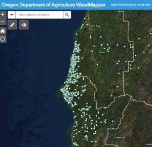
Mapping

Distribution

Where's the big map of yellow? Mapping a fast growing noxious weed infestation over a couple of million acres is not easy. Efforts and extent have varied across space, time, and jurisdiction. As technology advances so does our ability to share data. Below is the accumulated efforts the GAG partners to have the best information about where gorse is on the Southern Oregon Coast.

ODA Weedmapper

Oregon Department of Agriculture's Weedmapper application is a collection of spatial information on the distribution of noxious weeds.
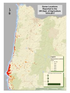
Oregon

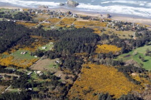
ODA Interactive map of gorse reported in Oregon.

Click to see infestations and choose from many base map options.

United States

Worldwide

CABI, Invasive Species Compendium

Modeling

In 2014 the Gorse Action Group partners procured 1-foot resolution imagery during the peak bloom. The imagery along with ground truthed data led to a classifiication analysis and a modeling effort aimed at accurately predicting gorse presence. Please contact us if you are interested in the imagery.